
The 10 most deprived areas in England have been revealed - and almost all of them are seaside towns and villages. New data has been published by the Ministry of Housing, Communities and Local Government, which outlines the most deprived neighbourhoods in the country in 2025.
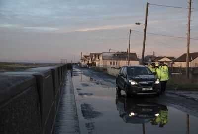
The most deprived area in England is Jaywick, an area in MP Nigel Farage's Clacton-on-sea constituency in Essex. The neighbourhood covers the Brooklands Estate and includes Jaywick Sands Promenade in Tendring. Tendring village is a tiny area with a population of just 748, within the Tendring District Council area. Despite being the most deprived area in England, Tendring area has over 36 miles of coastline, award-winning sandy beaches and numerous coastal towns including the Reform leader's Clacton seat.
Blackpool, another seaside town but in Lancashire, is the most heavily represented in the list, taking up 7 of the 10 positions and positions 2 to 6 in the Government list are all various neighbourhoods of Blackpool.
Breaking up the Blackpool neighbourhoods is Hastings, at number 7, described as a neighbourhood to the north-east of the coastal town of Hastings in East Sussex. The area is sandwiched between the suburbs of St Helen's and Ore and covers much of the housing on and around Chiltern Drive, Malvern Way and Ivyhouse Lane.
Then another two areas of Blackpool. Finally, rounding out the top 10 is in Rotherham. The neighbourhood of the South Yorkshire town is situated between the River Don and Clifton Park.
Nigel Farage said he is "sad" to see an area of his constituency once again named the most deprived neighbourhood in England, describing parts of it as "very depressed".
The latest official data shows that an area of the coastal village of Jaywick, close to the town of Clacton-on-Sea in the local authority of Tendring in Essex, has been classed the most deprived neighbourhood for the fourth time in a row.
Areas of Blackpool again make up most of the rest of the top 10, along with new appearances for neighbourhoods in Hastings and Rotherham.
Mr Farage, who was elected MP for Clacton in July 2024, told the PA news agency he was "obviously sad that things aren't improving more quickly" and while he felt he had helped with investment and tourism for the area, "there's a limit to what one person can do".
He expressed concern about potential gambling reforms appearing in next month's Budget, which he said could affect slot machines and pier amusement arcades.
Chancellor Rachel Reeves has been urged by anti-poverty campaigners and some Labour MPs to raise taxes on gambling firms, to cover the cost of lifting the two-child benefit cap.
Mr Farage added: "I'm worried with the Budget coming up that the situation might get worse."
Describing parts of Jaywick as "very depressed", he said: "Everybody just feels very, very burdened these days."
MHCLG said Middlesbrough, Birmingham, Hartlepool, Kingston-upon-Hull and Manchester are the local authority districts with the highest proportions of neighbourhoods among the most deprived in England.
The London boroughs of Tower Hamlets and Hackney were the most deprived in terms of income deprivation affecting children.
Both boroughs, and three other London boroughs, Newham, Islington and Southwark, ranked as the most deprived regarding income deprivation affecting older people, the department said.
Here is a list of the 10 most deprived neighbourhoods in England, according to the 2025 deprivation indices published by the Ministry of Housing, Communities & Local Government.
Each neighbourhood is identified not by a name but a number (known as the Lower-layer Super Output Area number, or LSOA).
This is followed by a brief description of the location of the neighbourhood.
1. Tendring 018A
A coastal area on the western side of the village of Jaywick, near Clacton-on-Sea in Essex. The neighbourhood covers the Brooklands Estate and includes Jaywick Sands Promenade.
2. Blackpool 010E
This area is immediately to the east of (or behind) the town hall and the Winter Gardens in the Lancashire seaside town. It includes St John's church and runs as far east as Buchanan Street and north towards Blackpool North railway station.
3. Blackpool 010A
A neighbourhood immediately north of the Odeon cinema in Blackpool, including Central Drive from Rigby Road to Chapel Street, and across to the Promenade opposite the town's central pier.
4. Blackpool 013A
This area lies to the north-west of Blackpool South railway station and covers most of Lytham Road and the Promenade up to the central pier.
5. Blackpool 011A
Another neighbourhood of Blackpool, this one bordered by Park Road, Palatine Road and Ashton Road.
6. Blackpool 008D
This area is immediately to the north of (or behind) Blackpool North railway station, along Talbot Road as far as Cooper Way, and towards the edge of Dickson Road.
7. Hastings 005A
A neighbourhood to the north-east of the coastal town of Hastings in East Sussex. The area is sandwiched between the suburbs of St Helen's and Ore and covers much of the housing on and around Chiltern Drive, Malvern Way and Ivyhouse Lane.
8. Blackpool 006B
The area between the North Shore and Claremont neighbourhoods of Blackpool, including Claremont Park and Westminster Primary Academy.
9. Blackpool 008B
A small residential area bordered by Blackpool North railway station, Talbot Road, Devonshire Road and Caunce Street.
10. Rotherham 017D
A residential area in the north-east of the South Yorkshire town, between the River Don and Clifton Park. It includes the junction of St Ann's Road and Fitzwilliam Road.
You may also like

"We go to therapy": Dwyane Wade opens up about how fathering a child with another woman affected his marriage to Gabrielle Union in a throwback interview
Stunned shoppers spot 'AI warning' on packets of noodles in supermarkets
BBC Celebrity Traitors fans in tears as 'iconic' star eliminated before final
Tesco introduces major change to delivery service - and it's good news for shoppers
Claudia Winkleman accidentally 'drops clue' about Cat Burns in Celebrity Traitors


